Property Record
1860 Spillway Rd, Brandon, MS 39047
NEARBY LISTINGS FOR SALE OR LEASE
Property Detail
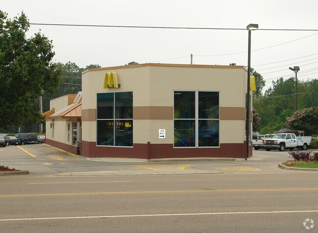
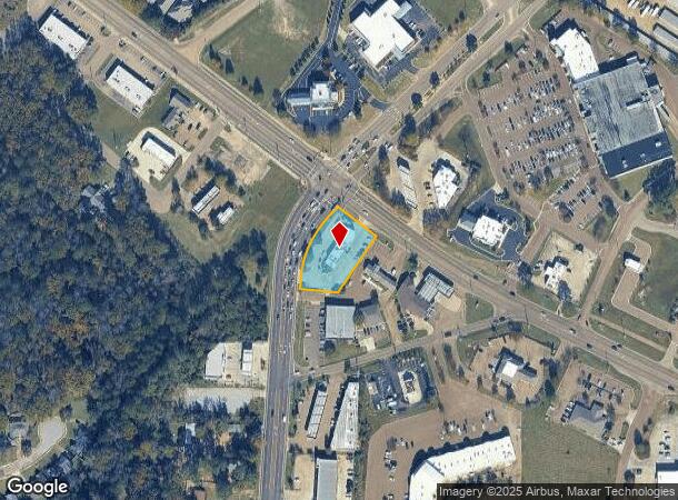
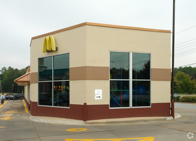
1860 Spillway Rd
G12-000032-00011
LOT 208 X 109.66 X 58.75 X 110.77 X 112.47 X 145 IN NE4 S OF SPILLWAY RD E OF HWY 468 & NORTHSHORE CAUSEWAY DB 689- 689 PG 03
Restaurantbuilding
Rankin
X
Mississippi
28121C0070G
208
2024
0.79 AC
2024
Outlying Rankin County
020214
Jackson
3,867 SF
Jackson, MS
DEMOGRAPHICS near 1860 Spillway Rd
1 Mile
3 Mile
5 Mile
2024 Total Population
7,387
27,000
63,871
2029 Population
7,631
27,843
65,272
Pop Growth 2024-2029
+ 3.30%
+ 3.12%
+ 2.19%
Average Age
39
40
39
2024 Total Households
3,299
11,137
27,331
HH Growth 2024-2029
+ 3.46%
+ 3.19%
+ 2.20%
Median Household Inc
$81,160
$90,053
$75,059
Avg Household Size
2.20
2.40
2.30
2024 Avg HH Vehicles
2.00
2.00
2.00
Median Home Value
$220,809
$236,409
$234,568
Median Year Built
1998
1997
1992
Nearby Places
Map Layers
Map Styles
 Street
 Aerial
- Restaurants
- Banks
- Shops
- Fitness
- Groceries
PUBLIC TRANSPORTATION
AIRPORT
Jackson-Medgar Wiley Evers International
DRIVE
WALK
Distance
Jackson-Medgar Wiley Evers International
20 min
10.4 mi
Freight Ports
Port of Gulf Port
DRIVE
WALK
Distance
Port of Gulf Port
208 min
168.2 mi
Nearby Properties
Address
Land Use
TOTAL SIZE
Lot Size
Zoning
Address
Land Use
TOTAL SIZE
Lot Size
Zoning
8,030 SF
222.20 AC
Address
Land Use
TOTAL SIZE
Lot Size
Zoning
8,896 SF
12.73 AC
Address
Land Use
TOTAL SIZE
Lot Size
Zoning
1,490 SF
15.24 AC
Address
Land Use
TOTAL SIZE
Lot Size
Zoning
191,219 SF
22.21 AC
Address
Land Use
TOTAL SIZE
Lot Size
Zoning
125,227 SF
8.91 AC
Address
Land Use
TOTAL SIZE
Lot Size
Zoning
19,971 SF
9.56 AC
Address
Land Use
TOTAL SIZE
Lot Size
Zoning
12,416 SF
9.22 AC
Address
Land Use
TOTAL SIZE
Lot Size
Zoning
12,464 SF
9.79 AC
Address
Land Use
TOTAL SIZE
Lot Size
Zoning
3,358 SF
6.12 AC
Address
Land Use
TOTAL SIZE
Lot Size
Zoning
11,284 SF
7.60 AC
Address
Land Use
TOTAL SIZE
Lot Size
Zoning
57,358 SF
2.08 AC
Address
Land Use
TOTAL SIZE
Lot Size
Zoning
47,009 SF
6.85 AC
Address
Land Use
TOTAL SIZE
Lot Size
Zoning
2,853 SF
8.68 AC
Address
Land Use
TOTAL SIZE
Lot Size
Zoning
78,049 SF
5.44 AC
Address
Land Use
TOTAL SIZE
Lot Size
Zoning
63,403 SF
7.69 AC
Address
Land Use
TOTAL SIZE
Lot Size
Zoning
19,300 SF
5.98 AC
Address
Land Use
TOTAL SIZE
Lot Size
Zoning
76,236 SF
8.05 AC
Address
Land Use
TOTAL SIZE
Lot Size
Zoning
48,637 SF
2.55 AC
Address
Land Use
TOTAL SIZE
Lot Size
Zoning
41,992 SF
2.17 AC
Address
Land Use
TOTAL SIZE
Lot Size
Zoning
11,447 SF
9.63 AC
Address
Land Use
TOTAL SIZE
Lot Size
Zoning
5,915 SF
0.73 AC
Address
Land Use
TOTAL SIZE
Lot Size
Zoning
83,567 SF
4.68 AC
Address
Land Use
TOTAL SIZE
Lot Size
Zoning
55,380 SF
7.79 AC
Address
Land Use
TOTAL SIZE
Lot Size
Zoning
56,249 SF
5.28 AC
Address
Land Use
TOTAL SIZE
Lot Size
Zoning
43,433 SF
0.95 AC
Address
Land Use
TOTAL SIZE
Lot Size
Zoning
6.98 AC
Address
Land Use
TOTAL SIZE
Lot Size
Zoning
43,549 SF
5.96 AC
Address
Land Use
TOTAL SIZE
Lot Size
Zoning
4,670 SF
2.47 AC
Address
Land Use
TOTAL SIZE
Lot Size
Zoning
82,391 SF
2.68 AC
The World's #1 Commercial Real Estate Marketplace
Connect with us
© 2026 CoStar Group
The information above has been obtained from sources believed reliable. While we do not doubt its accuracy we have not verified it and make no guarantee, warranty or representation about it. It is your responsibility to independently confirm its accuracy and completeness. Any projections, opinions, assumptions, or estimates used are for example only and do not represent the current or future performance of the property. The value of this transaction to you depends on tax and other factors which should be evaluated by your tax, financial, and legal advisors. You and your advisors should conduct a careful, independent investigation of the property to determine to your satisfaction the suitability of the property for your needs.